What 8-million-year-old stalagmites reveal about Saudi Arabia’s lost green past

Researchers at Northumbria University discovered there were multiple humid phases in central Arabia over millions of years. (Getty Images)
Short Url
Updated 27 April 2025
Follow

What 8-million-year-old stalagmites reveal about Saudi Arabia’s lost green past

  • Researchers discovered there were multiple humid phases in central Arabia that likely fed ancient river systems
  • These wet periods likely transformed arid deserts into green corridors for animal and early human migration out of Africa

LONDON: Two major surprises greeted researchers in the Department of Geography and Environmental Sciences at Northumbria University when they returned to the UK from Saudi Arabia with samples of ancient stalagmites collected in caves northeast of Riyadh.

The plan was to use the samples to identify specific humid phases in central Arabia over the past million years or so which would have temporarily “greened” the more usually arid region, transforming the so-called Saharo-Arabian Desert Barrier into a land bridge across which many mammalian species ­—­ including early humans — would have made the journey out of Africa.


Hubert Vonhof (right), geologist at the Max Planck Institute for Chemistry, and Alexander Budsky, scientist at the State Museum in Kärten, were part of the team that analyzed dripstones from Saudi Arabian caves. (Supplied)

The initial surprise was that the first, commonly employed technique they used to date such samples did not work.

Two different radiometric dating methods are used to date the calcium carbonate laid down in stalagmites — uranium-thorium (U-Th) and uranium-lead (U-Pb) — which both measure the extent to which radioactive isotopes in the material have decayed.

“At first we suspected the stalagmites might be quite a lot younger, so we used the uranium-thorium method,” said Monika Markowska, a senior research fellow in the Geography and Environmental Sciences Department at Northumbria University in Newcastle, England.

“This method is good only for about 600,000 years, and we kept finding we couldn’t date anything.”

Then came the second surprise, revealed in a paper published in the journal Nature this month.

“So, we switched to the uranium-lead method and all of a sudden it revealed just how old these stalagmites were,” she said.

“There was this sudden realization in the lab: ‘Oh my goodness, these are 8 million years old.’ It was quite a moment.”

At a stroke, the story of life in central Arabia had been pushed back more than 7 million years.

Stalagmites, stalactites and “flowstones,” known collectively as speleothems, are created on the floors, roofs and walls of caves by rainwater dripping through from the surface.


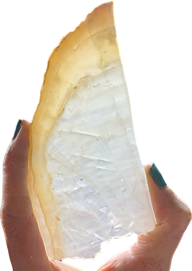
A cross-section of one of the stalagmites taken for analysis. (Supplied)

As water passes through the soil or rock above a cave, it collects minerals, including calcium carbonate. In the case of stalagmites, over many millennia, these minerals form conical towers, slowly growing up from the floor of the cave.

The age and rate at which these stalagmites have grown can be accurately measured using various methods of radiometric dating, which calculates a material’s age by measuring the presence of radioactive elements.

Until recently, evidence of environmental conditions in Arabia extended back only 450,000 years. But in 2020, a paper published in the International Journal of Earth, Climate and Life Interactions reported that analysis of stalagmites collected from caves in southern Arabia — Yemen and northern Oman — had pushed the record back 1.1 million years.

In that time, analysis of the stalagmites revealed there had been no fewer than 21 “pluvial periods” — periods of increased rainfall, creating “numerous opportunities” for early humans to migrate out of Africa and into Eurasia, unimpeded by the more typical periods of arid weather and desert conditions that otherwise acted as barriers to early human dispersal.

But, as the authors of the latest research report in Nature said, “although numerous humid phases occurred in southern Arabia during the past 1.1 million years, little is known about Arabia’s paleoclimate before this time.”

The new research has now pushed back the region’s hydroclimate record a further 7 million years, in the process revealing much earlier “recurrent humid periods characterized by increased water availability and vegetation cover.”

The caves selected for the study, located in the Al-Sulb Plateau, northeast of Riyadh, had been identified by the Saudi Geological Survey.


The Saudi Geological Survey (SGS) says there are over 150 caves recognized for their remarkable scientific significance in Saudi Arabia. (SPA)

“What drew us to this site was the fact that the modern landscape there is hyper arid, yet in the caves we see lots of evidence of stalactite and stalagmite growth,” said Markowska. “This means that it was wetter in the past because these just don’t form under the modern conditions.”

For “conservation reasons,” the paper gives only the general locations of the caves. However, the precise coordinates are available to some professional organizations and researchers from the Saudi Heritage Commission and the Saudi Geological Survey.

The story told by the 22 speleothems collected from the seven cave systems, all found within a 10 km radius, is an extraordinary one. Analysis of the samples has revealed a series of humid episodes over four distinct periods — between 0.86 and 1.37 million years ago (Ma), 2.01 and 2.29 Ma, 3.16 and 4.10 Ma, and 6.25 and 7.44 Ma.

This last humid episode occurred during what geologists classify as the Late Miocene. This is the period from which numerous fossils found further south, in the UAE, date — the remains of animals such as elephants, hippopotamuses, crocodiles, antelopes, hyenas and large carnivores, including saber-toothed cats, which have been unearthed in the Western Region of the emirate of Abu Dhabi.

These animals flourished there, according to a summary of decades of research published in 2012, thanks to “a very large river system flowing slowly through the area, along which was flourishing vegetation, including large trees.”

That river system may well have flowed from the interior of Arabia — and the fresh evidence from the caves northeast of Riyadh suggests the possibility that it was rainfall here that fed it.


Monika Markowska in the lab at Northumbria University. (Supplied)

“There is evidence in Arabia of rivers in the past, and certainly in the UAE fossils have been found where a river channel once ran,” said Markowska.

“But rivers can have very distant origins and the big thing about our paper is that for the first time we were able to determine that there was rainfall specifically in the center of the desert — evidence of actual rainfall in that area, rather than humidity from rivers that were sourced from distant locations.

“Before now, we knew a little bit about what was going on in the south of Arabia, that there were numerous humid phases going back over the past 1.1 million years. But we’ve been able to push that back to 8 million years, and this is for the center of the desert, where there was really no information before.”

The importance of this discovery is highlighted by the vast well of international specialist knowledge upon which the study drew. This is reflected in the list of the paper’s 31 co-authors, who include researchers and specialists from universities in the UK, Germany, Switzerland, Australia and the US.

It also includes the College of Tourism and Archaeology at King Saud University in Riyadh, the Kingdom’s Heritage Commission, Geotourism Department and the Saudi Geological Survey.

The paper thanks Prince Badr bin Abdullah bin Farhan Al-Saud, the Saudi minister of culture, for giving his permission for the research to be carried out, and acknowledges the vital role of the Heritage Commission in providing logistical and technical field support.


Prince Badr bin Abdullah bin Farhan, culture minister of Saudi Arabia. (SPA)

So far, as the paper makes clear, the “vertebrate fossil record of Arabia is scant,” with remains found only in two principal locations: The sandstone and mudstone Baynunah Formation in the UAE and the Nefud Desert in northwestern Saudi Arabia.

The fossils in the Nefud are “only” about 500,000 years old, and 6 million years younger than those from the Baynunah Formation, currently the only site where animal remains dating from the Late Miocene have been found.

But, said Markowska, the lack of fossil evidence from the same period in central Arabia “doesn’t necessarily mean there wasn’t fauna there at that time, but only that we haven’t found them yet.”

And, as the paper concludes, “considering our findings, it seems probable that movements between Africa and Eurasia would have taken place through the Arabian Peninsula, which, during humid phases, was likely characterized by well-watered grasslands and woodlands.”

Many of the animal species identified from fossilized remains in the UAE “would have been well suited for life in (central) Arabia during the wet episodes identified in our speleothem record. The scant fossil record aside, we suggest that Arabia probably acted as a hitherto unrecognized but important crossroad for biogeographic exchange between Africa and Eurasia over the past 8 million years.”

The researchers add that “the nature of these exchanges, and the exact role of Arabia in these, may only be elucidated with an improved fossil record.”

For now, a more pressing piece of research is underway, for the stalagmites of Saudi Arabia have more secrets to divulge.


Stunning view of Ain Heet cave, located in a mountain called Al-Jubayl in a small village in Wadi Al-Sulay, Riyadh.  Ain Heet is named after its entrance, which resembles the shape of the eye. The cave is formed with limestone. (AN file photo)

Finding out exactly what plants and trees thrived during the wet periods over the past 8 million years is key to understanding what species of herbivorous mammals — and, therefore, the meat-eaters that preyed upon them — might have existed in the once greener, lusher Saudi Arabia.

“This vegetation issue is our big next research question,” said Markowska.

“We have been able to identify these humid periods, and to identify what the dominant mechanisms for causing them were — basically, more moisture coming up from the south, during monsoon seasons. But we’re also very interested in this vegetation story.”

As speleothems grow, “they trap tiny amounts of pollen within their structure, and now we’re going to see if we can extract some ancient pollen from the speleothems, which is a technique we specialize in at Northumbria.”

This is a painstaking effort, “which involves a lot of microscope work. You extract the material, put it on a microscope slide and then count and identify the different pollen grains you find. I work with other colleagues who are experts on (ancient) pollen, and together I think we should be able to unwrap this other side of the story.”


What new technologies are revealing about the Silk Road’s forgotten landscapes

Updated 17 January 2026
Follow

What new technologies are revealing about the Silk Road’s forgotten landscapes

  • Drones and digital tools are allowing archaeologists to map vast areas in hours rather than months of ground surveys
  • In Saudi Arabia, aerial mapping has uncovered dense prehistoric and Bronze Age sites previously thought to be empty

DUBAI: Across the deserts and mountain valleys of the Arab world, drones are now doing work that once took teams of archaeologists months to complete.

In northern Saudi Arabia, for example, aerial surveys can map an entire ancient settlement in minutes, revealing faint outlines of walls, pathways and structures hidden beneath the surface.

These images are later turned into 3D models — part of a growing effort across the region to use technology to trace old trade routes, map forgotten sites and better understand how people once moved across Arabia and beyond.

Much of this work is connected to renewed interest in the Silk Road and the networks that once linked Arabia with the wider world.

Harrat, Khaybar. (Supplied)

The Silk Road refers to a network of ancient trade routes that linked East Asia with the Middle East, North Africa and Europe for more than 1,500 years.

Rather than a single road, it was a vast web of caravan paths and maritime corridors connecting cities from China and Central Asia to Iran, Iraq, the Arabian Peninsula, the Levant and the Mediterranean.

Along these routes, merchants, scholars and travelers exchanged goods such as silk, spices and metalwork, as well as ideas, technologies and cultural traditions that shaped the development of the wider region.

In more recent times, scholars, students and heritage authorities across the Middle East and Central Asia are increasingly relying on drones, laser scanning, photogrammetry and satellite analysis to document archaeological landscapes.

In Saudi Arabia’s AlUla and Khaybar regions — now considered some of the world’s densest concentrations of prehistoric and Bronze Age structures — drone surveys have helped researchers record sites that would otherwise remain inaccessible.

Dr. Hugh Thomas, a lecturer in archaeology at the University of Sydney and co-director of the Prehistoric AlUla and Khaybar Excavation Project, says the scale of the Saudi landscape makes aerial work essential.

“Saudi Arabia contains an exceptionally dense archaeological landscape distributed across a vast geographic area,” he told Arab News. “Drone-based surveys allow large volumes of archaeological data to be collected efficiently.” 

A Neolithic mustatil next to a Bronze Age pendant burial in Kaybar. (Supplied/Mat Dalton)

Indeed, many structures sit on steep or remote terrain that ground teams cannot easily reach. This shift to aerial archaeology has also revealed details that would be almost impossible to see from ground level.

Thomas notes that researchers have long suspected a link between water sources and Neolithic mustatil structures, which date back approximately 7,000 years. In 2020, drone images captured by his team near Khaybar also strengthened theories linking mustatil to water sources.

“The drone images revealed that recent rains had settled in specific parts of wadi valleys, exactly where the mustatil were built,” he said. Since then, multiple surveys and peer-reviewed studies have supported this connection, with many mustatil shown to point directly toward water.

In parallel, new technologies are reshaping how archaeologists understand the wider landscape. Thomas says tools such as drones, satellite imagery and 3D modelling allow researchers to document vast areas quickly and at far higher resolution than ever before.

These approaches “enable the rapid, cost-effective documentation of this vast and previously understudied landscape” and create permanent digital records that support long-term monitoring and analysis, he said.

This has been transformative for understanding past movement and land use.

Remote sensing work in northern Saudi Arabia has revealed extensive Bronze Age funerary avenues — pathways lined with monumental tombs, running for thousands of kilometers and linking major oases such as Khaybar, Al-Hait and Al-Huwayyitt.

Drone surveys and 3D models have allowed researchers to classify tomb types more accurately and identify where excavation would yield the most useful results. Thomas says these techniques directly contributed to one of the project’s most significant achievements.

“This has ultimately assisted us with our most recent paper, where we were able to publish the C14 dates of remains found in 40 Bronze Age tombs, helping us understand when these tombs appeared on the landscape and how they developed over time,” he said.

While international collaborations play a central role, Thomas says long-term progress in the Kingdom depends on building local capacity.

He says contributions from Saudi researchers, students and even members of the public are becoming increasingly important.

Archaeologist Don Boyer measures a tower of stones next to a 525m long Mustatil in Khaybar. (David Kennedy)

“Local researchers, students, and members of the public are taking photographs of archaeological sites and sharing them digitally,” he said. “Each image provides a lasting record of archaeological remains.”

In Saudi Arabia’s AlUla, one of the region’s most active archaeological hubs, the Royal Commission for AlUla has supported wide-ranging surveys that combine aerial photography, remote sensing and targeted excavation.

Published research from the AlUla and Khaybar Aerial Archaeology Project describes how thousands of structures — from ancient hunting traps to tombs and settlements — have been recorded using these methods in recent years.

“We’re seeing landscapes we did not even know existed before this kind of work began,” said archaeologist Dr. Rebecca Repper of the University of Sydney in an RCU briefing. 

“Technology is helping us reassess northern Arabia’s role in long-distance connections.”

Recent research across Central Asia shows how drones and LiDAR, a remote-sensing technology used to create extremely accurate 3D maps of landscapes, buildings, or buried features, are transforming the study of Silk Road-era landscapes.

In Uzbekistan, a team led by Dr. Michael Frachetti — an archaeologist at Washington University in St. Louis, who specializes in ancient mobility systems — used drone-mounted LiDAR to scan remote high-altitude terrain, revealing two previously undocumented medieval cities, Tugunbulak and Tashbulak.

Researchers excavate medieval pottery at the newly rediscovered medieval Silk Road city Tugunbulak located in the mountains of southeastern Uzbekistan June 8, 2022 (Michael Frachetti)

A 2024 peer-reviewed study, “Automated analysis of high-resolution lidar traces large-scale medieval urbanism in highland Central Asia,” details how these surveys exposed plazas, fortifications and settlement layouts previously invisible from the ground.

In southeast Kazakhstan, a 2021 study in the journal Applied Sciences shows how UAV photogrammetry helped map irrigation networks, settlement traces and burial mounds linked to medieval trade and pastoral routes.

Together, these findings demonstrate how high-resolution aerial mapping is reshaping our understanding of the landscapes and movement patterns that framed the Silk Road.

For governments, these discoveries are more than scientific. UNESCO describes the Silk Roads as a shared heritage space where cooperation is critical, and regional countries have increasingly embraced cross-border research partnerships.

In Saudi Arabia, AlUla’s collaborations with universities including Oxford, Bologna and the French National Centre for Scientific Research reflect a growing diplomatic interest in cultural research.

These partnerships have generated shared excavations, joint field schools and open-access databases — opportunities that were rare in the region two decades ago.

Digital access is also reshaping how the public engages with this history.

The International Dunhuang Project, a global consortium led by the British Library and multiple Asian national libraries, has digitized hundreds of thousands of manuscripts, murals and archaeological fragments linked to the Silk Road.

Its open platform has become a major educational resource for schools and researchers worldwide.

A LiDAR image of Tugunbulak shows a dense settlement along a ridge. (Michael Frachetti)

In AlUla, digital reconstructions and virtual models are increasingly used in classroom activities and community programs.

Youth involvement is part of this shift. In Saudi Arabia, RCU’s assorted heritage guardian programs introduce young people to survey techniques, basic archaeology and remote-sensing tools, helping train a new generation of community researchers.

In parts of Central Asia, student volunteers often support field surveys and digital documentation under national heritage ministries and international missions.

Across deserts, mountains and oasis towns, a fuller picture of ancient networks is beginning to emerge. Every drone flight reveals structures long buried under sand and stone.

“On the plateau, we found a hidden valley with large mounds and undulations on the surface,” Frachetti explained in a Washington University Magazine feature about his team’s drone-assisted work.

“It was obvious, both in person and on the drone-acquired surface model we created, that we had stumbled across something much larger and different from the typical campsite we had expected.”

Recent archaeological work has discovered a fortified 2.6-hectares Bronze Age town (al Natah) in Khaybar oasis (dating around 2400 BCE- 1300 BCE). (RCU)

Meanwhile, every 3D model helps trace how people once traveled, traded and settled across continents.

And every partnership — whether in AlUla, the Gulf, or Central Asia — reinforces the idea that this heritage connects far more than a single nation.

The Silk Road’s story is being rediscovered not through speculation but through data, satellites and the work of a generation that is documenting the past with new precision.