

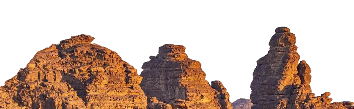
MAKKAH: In the heart of NEOM’s Hisma Desert, where sandstone mountains and plateaus rise from the arid landscape, is an extraordinary collection of ancient rock art and archaeological inscriptions. These priceless treasures illuminate the cultural and economic vitality of long-lost civilizations.
Once a vital corridor for caravans travelling the ancient trade routes of the Arabian Peninsula, this region preserves an invaluable legacy etched into its geological formations.
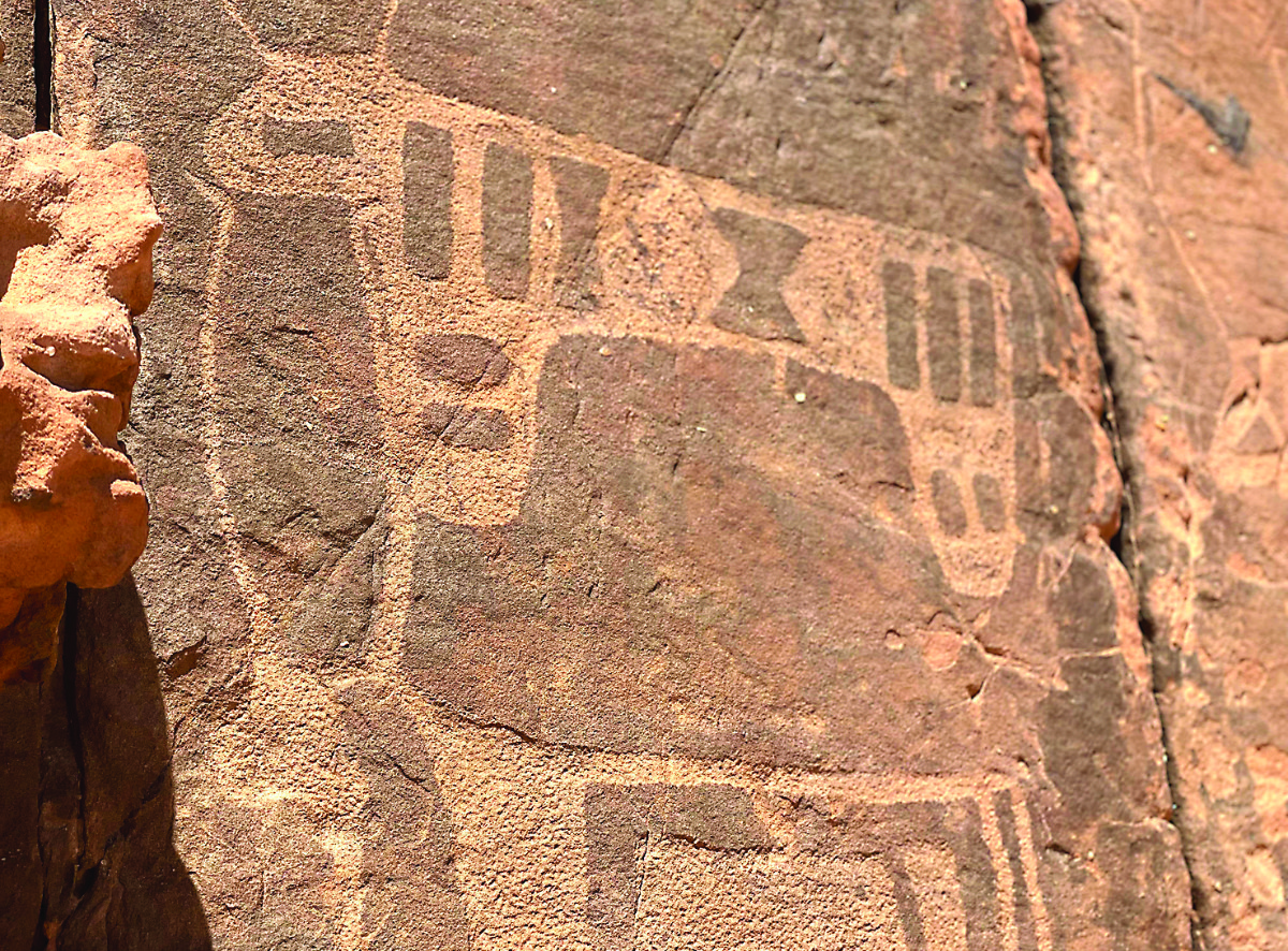
The drawings show how people interacted with now-extinct animals in the area, as well as with livestock and camels. (Supplied)
Abdulelah Al-Fares, a photographer and expert in ancient artifacts and a member of the Saudi Heritage Preservation Society, told Arab News that the rock art is in the mountains and plateaus in NEOM, part of a mountain range in the northwestern part of Tabuk.
Hisma Desert is bordered by the Sharah Mountains to the north, by Wadi Araba to the northwest, by the Hijaz Mountains to the west, and by Harrat Al-Raha to the south.
HIGHLIGHTS
• Studying rock art in the region matters deeply because it reveals economic and cultural changes that shaped the northern Arabian Peninsula.
• The drawings show how people interacted with now-extinct animals in the area, as well as with livestock and camels.
• Among the standout examples are life-sized camels crafted with remarkable precision and aesthetic detail.
“The plateaus, part of the Hisma Desert and its geological formations, represent an open-air museum of nature, ancient rock art, and diverse historical inscriptions,” he said.
The artworks illuminate the journey of human civilization, revealing its cultural and social evolution in the region. (Supplied)
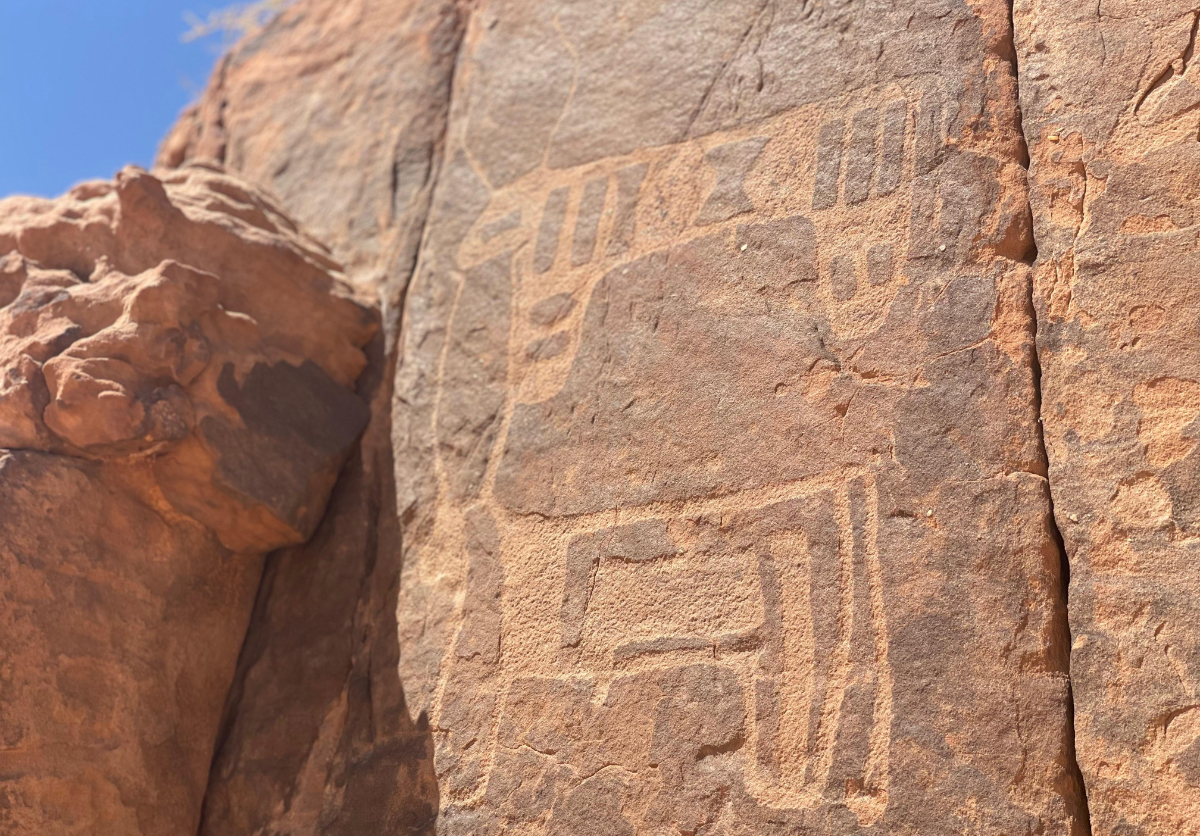
The rock drawings feature engravings of human figures, animals and various scattered scenes throughout the site.
The engravings on the plateau’s facades depict scenes of animals, including wild animals such as camels, cattle, ibexes, ostriches and wolves, as well as other predatory animals, and depictions of hunting scenes and human combat.
These drawings are notable for their precision and have remarkably withstood the elements for thousands of years.
Abdulelah Al-Fares, Saudi Heritage Preservation Society member
“These drawings are notable for their precision and have remarkably withstood the elements for thousands of years,” he said. “Most of the themes and scenes in some of the rock drawings in the region are repeated and depict, to some extent, the world of wild animals and the interactions of humans through hunting and warfare.
“The mountains embody a civilizational and cultural legacy through their distinctive rock drawings featuring human and animal forms,” Al-Fares said.
The rock drawings feature engravings of human figures, animals and various scattered scenes throughout the site. (Supplied)
He also highlighted the value of exploring NEOM’s ancient rock art. These carvings — depicting animals, hunting scenes and human figures — are a bridge between our modern lives and the world of humans thousands of years ago. They are a source of cultural and historical knowledge.
The artworks also illuminate the journey of human civilization, revealing its cultural and social evolution in the region.
Scattered throughout the area, a wide array of rock art sites show a vast and dense collection of drawings and archaeological inscriptions from different eras etched on mountain surfaces.
Al-Fares pointed out their diversity, noting the varied artistic styles, forms, and themes that distinguish each piece.
Among the standout examples are life-sized camels crafted with remarkable precision and aesthetic detail. The careful attention to detail is thought to underscore the camel’s role as an essential sources of food and transport in ancient times.
Another façade shows a herd of cows, all facing forward, their large crescent-shaped horns curving at the tips. Encircling this herd, human figures of varying sizes are skilfully carved.
These ancient artworks are pictorial panels of human history, activity, environmental adaptation, and cultural development during ancient times. Their value shines brighter given the scarcity of insights into prehistoric life.
Studying rock art in the region matters deeply because it reveals economic and cultural changes that shaped the northern Arabian Peninsula.
The drawings show how people interacted with now-extinct animals in the area, as well as with livestock and camels.
Many carvings portray human beings astride animals, including a warrior wielding a spear and sword, rendered with finesse and skill.
Scattered throughout the region, some drawings hint at the presence of different ethnic groups that lived in the area. The provide clues to migratiosn and trace the routes of trade caravans that used these locations as settlement points.


