


JEDDAH: In our hectic world, nature escapes have become a growing trend, attracting different types of people with a range of experiences and adventures, and creating new business opportunities and nature-based adventure tourism.
Now, after months of lockdown, residents of the Kingdom are seeking new ways of experiencing life’s adventures and there is no better place than our own backyard.
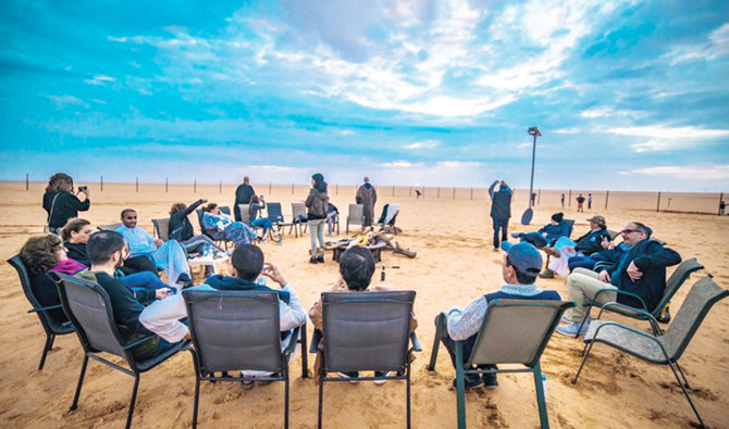
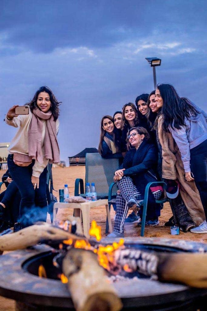
In Saudi Arabia, desert adventures are gaining increasing popularity among citizens and residents, as well as international tourists seeking the ultimate desert experience to discover the culture, customs and nomadic way of life.
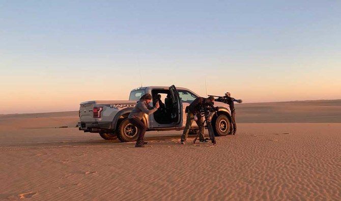
Delta Adventures, a Saudi-based adventure excursion business that opened in 2018, offers unforgettable adventures to the beautiful unreachable destinations in the Arabian Peninsula, including the Empty Quarter, for a varied clientele.
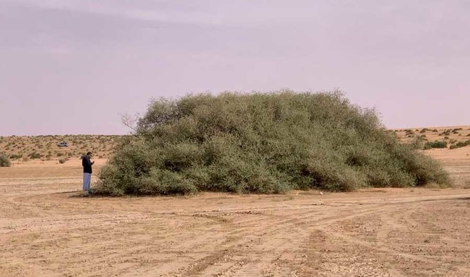
Though it may suggest emptiness, loneliness and a lack of basic needs, deserts are diverse and they attract different types of tourists.
Some people look to the desert for a digital detox and to escape the bustle of demanding city life, while others, such as hikers, campers and nature lovers, seek fun adventures. Deserts also offer something for archaeology and history enthusiasts.
Muhammad and Eddie, sons of Sheikh Abdullah bin Khamis and founders of Delta Adventures, were inspired by their father, a Saudi intellectual and historian who influenced the geographical and historical documentation and research of the country’s deserts.
Bin Khamis has written over 50 works of literature, poetry, criticism, and history.
“We have a long accumulated experience and knowledge about desert trips for more than 40 years, as we used to accompany our father,” Muhammad bin Khamis told Arab News.

After their father died, the two brothers continued planning trips with friends and families, as well as diplomats, and by the end of 2018 had established their company in Riyadh to provide their services to travelers and break new ground in the area of desert tourism.
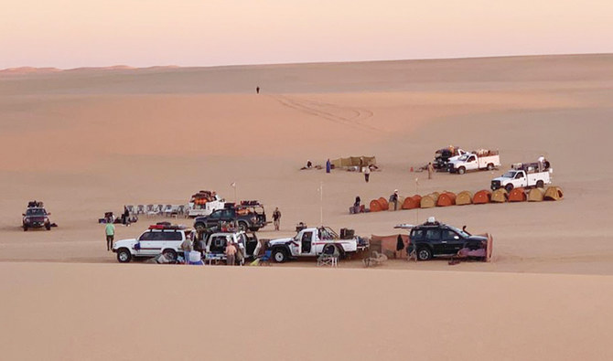
Delta Adventures designs trips in accordance with their clients’ requests, and is the first in the country to specialize in organizing trips to Rub’ Al-Khali (the Empty Quarter), also known as “The Abode of Emptiness.”
BACKGROUND
● Delta Adventures, a Saudi-based adventure excursion business that opened in 2018, offers unforgettable adventures to the beautiful unreachable destinations in the Arabian Peninsula.
● Muhammad and Eddie, sons of Sheikh Abdullah bin Khamis and founders of Delta Adventures, were inspired by their father, a Saudi intellectual and historian who influenced the geographical and historical documentation and research of the country’s deserts.
The vast area of desert located in the southern half of Saudi Arabia was not unexplored until the 1930s. Though the name suggests a barren, desolate place, many explorers consider it the ultimate resemblance of nature’s sheer beauty and power.
“Considering that desert tourism is an emerging market in the Kingdom, this gives us an opportunity to invest our experience in these type of projects to develop domestic tourism,” bin Khamis said.
“We aim to take advantage of the facilities provided by the Saudi government to contribute to the advancement of this sector in the country, in accordance with Vision 2030 that aspires to make tourism revenues contribute 10 percent of the country’s gross domestic product.”
Desert tourism is a perfect choice for visitors looking for tranquility, rest, and connection with nature.
It will also appeal to cultural visitors as well as gastronomic and nature lovers. Delta Adventures offers a wide range of long and short trips to different destinations with natural and historical value around the Kingdom, with a wide range of prices, too.
“By the end of our trips to unreachable places, we want to make our customers permanent ambassadors of Delta Adventures in their communities,” Bin Khamis said, adding: “We have been keen in choosing diverse sites for our trips to meet all tastes and aspirations. Until now, residents in Saudi Arabia have been our main customers, and we have previously taken five ambassadors and three of their wives on a 10-day trip to the Empty Quarter.”
He added: “There is also an increasing interest in such activities from overseas tourists and citizens. This season was our biggest so far, and it is encouraging us to offer our best.”
Bin Khamis said that desert tourism will play a massive role in the country’s growing tourism sector, especially with the Kingdom’s deserts’ enchanting and diverse beauty.
Tourists are coming to Saudi Arabia, bored with the cities’ huge buildings and manifestations of civilization in their countries. They usually come wanting to see a different nat ure and live a unique experience, and this is what our wonderful desert offers them.
Muhammad bin Khamis, Delta Adventures
“Tourists are coming to Saudi Arabia, bored with the cities’ huge buildings and manifestations of civilization in their countries. They usually come wanting to see a different nature and live a unique experience, and this is what our wonderful desert offers them.”
According to Bin Khamis, desert tourism is possible over three seasons of the year and varies from one region to another. For example, the Empty Quarter trips start from the beginning of November till the end of February, while trips to the northern regions such as Hail, Al-Jawf and Al-Ula begin from mid-September to mid-May.
Bin Khamis said the spirit of adventure and exploration is part of human nature, but has shrunk in modern life.
He said that people traveling in Saudi Arabia find their souls in the silent world, far away from any polluting sight, under the deserts’ night sky.
“People have the right to fear leaving their lives’ welfare, but as the Tunisian poet Abu Al-Qasim Al-Shabbi said: ‘He who doesn’t like to climb mountains will forever live among the hollows,’” said Bin Khamis.
He added that adventure tourism is different from any other type of travel, and is a fuller experience, as it relates to suspense, enjoyment, self-exploration, and discovering and learning new things.
Bin Khamis agreed that adventure tourism had become one of the most prominent tourist trends in recent years, and is more popular among young people.
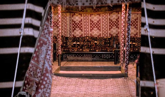
Delta Adventures welcomes anyone who is in good health to join its trips.
“We provide participants with everything from a sleeping tent and bedding for each participant, in addition to meals, refreshments, as well as care and assistance.”


