The festival expects some 2,000 to 5,000 participants from around the world
Updated 12 October 2021
Zaid Khashogji
RIYADH: Riyadh will host the Global Town Festival for the second time, with the world’s civilizations coming together to give visitors unprecedented historical exploration and cross-cultural discovery for two weeks from Oct. 27.
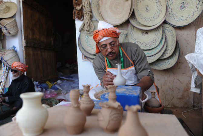
Countries from all around the world will participate in showcasing famous landmarks, markets, folklore, songs and chants, as well as high-end cafes and restaurants serving people delicious international cuisines.
Reema Alruwaysan, CEO of MOLHIMAH Group, told Arab News that visitors should expect an “exceptional” experience of unforgettable moments that will take them on a journey full of passion and suspense through time.
“We faced many difficulties with the first edition that, thankfully, we overcame, and it was a great success. For this year, I’m 95 percent certain it will be even better,” Alruwaysan said, adding: “It’s time for people around the world to discover the Kingdom of Saudi Arabia for what it really is and what it has to offer in culture and knowledge.
“We aim to showcase the country to everyone as it is, using Riyadh as the gate. The Kingdom is a nation that welcomes all under peace, love and tolerance. And this festival is all about cultural and recreational diplomacy.”
The venue, located at the Exhibition Park on Eastern Ring Road, Riyadh, will allow entry to visitors from 4:00 p.m. to 12:00 a.m. everyday until Nov. 9.
“The visitor’s journey begins from the Saudi Market, on a scenic and historical journey where time goes back and forth between past and present, passing through the regions of the Kingdom,” she said.
Visitors will get a chance to see ancient Najd, Darwaza al-Tumairi, and Souk Al-Muqaybara among others. The festival will be accompanied by an historical exhibition that displays the most prominent achievements of the Kingdom’s rulers.
While Global Village exists in the UAE, Alruwaysan assured Arab News that the festival in Riyadh will be a completely different cultural experience, with ambassadors expected to attend the opening.
The festival expects some 2,000 to 5,000 participants from around the world including countries such as “Kenya, Ethiopia, South Africa, Egypt, Italy, and France.”
Organizers said the festival will feature a dedicated charity street called “Molhimah Al-Khair,” in line with the Vision 2030 reform plans to empower women and invest in the youth of the country.
Alruwaysan said more than half of those participating at booths were not charged any fees for their businesses and commercial activities.
“We took in as many entrepreneurs as we could find and told them: ‘This place is for you, free of charge, so go and sell! And you can keep all the proceeds.’”
Alruwaysan revealed that the festival will include anime and manga shows, a digital games arena, in addition to ice cream, chocolate and rose kiosks as well as authentic “tarab” nights. The festival will host dedicated Italian, French and African streets, showcasing their rich culinary heritages.
Visit Saudi called the festival one of the “most distinguished, inclusive and entertaining cultural events” of the upcoming Riyadh Season, offering the best combination of Eastern and Western culture and civilization.
Ads for Riyadh Season lit up the streets of London and Newcastle on screens on Tuesday, tweeted by Turki Al-Sheikh.
Al-Sheikh announced earlier that Riyadh Season would launch on Oct. 20 with the first zone of 14 set to open on Oct. 21.
This year’s event is expected to run until March 2022, with more than 7,500 events that will cover an area of 5.4 million square meters across 14 districts in Riyadh.
DUBAI: Across the deserts and mountain valleys of the Arab world, drones are now doing work that once took teams of archaeologists months to complete.
In northern Saudi Arabia, for example, aerial surveys can map an entire ancient settlement in minutes, revealing faint outlines of walls, pathways and structures hidden beneath the surface.
These images are later turned into 3D models — part of a growing effort across the region to use technology to trace old trade routes, map forgotten sites and better understand how people once moved across Arabia and beyond.
Much of this work is connected to renewed interest in the Silk Road and the networks that once linked Arabia with the wider world.
Harrat, Khaybar. (Supplied)
The Silk Road refers to a network of ancient trade routes that linked East Asia with the Middle East, North Africa and Europe for more than 1,500 years.
Rather than a single road, it was a vast web of caravan paths and maritime corridors connecting cities from China and Central Asia to Iran, Iraq, the Arabian Peninsula, the Levant and the Mediterranean.
Along these routes, merchants, scholars and travelers exchanged goods such as silk, spices and metalwork, as well as ideas, technologies and cultural traditions that shaped the development of the wider region.
In more recent times, scholars, students and heritage authorities across the Middle East and Central Asia are increasingly relying on drones, laser scanning, photogrammetry and satellite analysis to document archaeological landscapes.
In Saudi Arabia’s AlUla and Khaybar regions — now considered some of the world’s densest concentrations of prehistoric and Bronze Age structures — drone surveys have helped researchers record sites that would otherwise remain inaccessible.
Dr. Hugh Thomas, a lecturer in archaeology at the University of Sydney and co-director of the Prehistoric AlUla and Khaybar Excavation Project, says the scale of the Saudi landscape makes aerial work essential.
“Saudi Arabia contains an exceptionally dense archaeological landscape distributed across a vast geographic area,” he told Arab News. “Drone-based surveys allow large volumes of archaeological data to be collected efficiently.”
A Neolithic mustatil next to a Bronze Age pendant burial in Kaybar. (Supplied/Mat Dalton)
Indeed, many structures sit on steep or remote terrain that ground teams cannot easily reach. This shift to aerial archaeology has also revealed details that would be almost impossible to see from ground level.
Thomas notes that researchers have long suspected a link between water sources and Neolithic mustatil structures, which date back approximately 7,000 years. In 2020, drone images captured by his team near Khaybar also strengthened theories linking mustatil to water sources.
“The drone images revealed that recent rains had settled in specific parts of wadi valleys, exactly where the mustatil were built,” he said. Since then, multiple surveys and peer-reviewed studies have supported this connection, with many mustatil shown to point directly toward water.
In parallel, new technologies are reshaping how archaeologists understand the wider landscape. Thomas says tools such as drones, satellite imagery and 3D modelling allow researchers to document vast areas quickly and at far higher resolution than ever before.
These approaches “enable the rapid, cost-effective documentation of this vast and previously understudied landscape” and create permanent digital records that support long-term monitoring and analysis, he said.
This has been transformative for understanding past movement and land use.
Remote sensing work in northern Saudi Arabia has revealed extensive Bronze Age funerary avenues — pathways lined with monumental tombs, running for thousands of kilometers and linking major oases such as Khaybar, Al-Hait and Al-Huwayyitt.
Drone surveys and 3D models have allowed researchers to classify tomb types more accurately and identify where excavation would yield the most useful results. Thomas says these techniques directly contributed to one of the project’s most significant achievements.
“This has ultimately assisted us with our most recent paper, where we were able to publish the C14 dates of remains found in 40 Bronze Age tombs, helping us understand when these tombs appeared on the landscape and how they developed over time,” he said.
While international collaborations play a central role, Thomas says long-term progress in the Kingdom depends on building local capacity.
He says contributions from Saudi researchers, students and even members of the public are becoming increasingly important.
Archaeologist Don Boyer measures a tower of stones next to a 525m long Mustatil in Khaybar. (David Kennedy)
“Local researchers, students, and members of the public are taking photographs of archaeological sites and sharing them digitally,” he said. “Each image provides a lasting record of archaeological remains.”
In Saudi Arabia’s AlUla, one of the region’s most active archaeological hubs, the Royal Commission for AlUla has supported wide-ranging surveys that combine aerial photography, remote sensing and targeted excavation.
Published research from the AlUla and Khaybar Aerial Archaeology Project describes how thousands of structures — from ancient hunting traps to tombs and settlements — have been recorded using these methods in recent years.
“We’re seeing landscapes we did not even know existed before this kind of work began,” said archaeologist Dr. Rebecca Repper of the University of Sydney in an RCU briefing.
“Technology is helping us reassess northern Arabia’s role in long-distance connections.”
Recent research across Central Asia shows how drones and LiDAR, a remote-sensing technology used to create extremely accurate 3D maps of landscapes, buildings, or buried features, are transforming the study of Silk Road-era landscapes.
In Uzbekistan, a team led by Dr. Michael Frachetti — an archaeologist at Washington University in St. Louis, who specializes in ancient mobility systems — used drone-mounted LiDAR to scan remote high-altitude terrain, revealing two previously undocumented medieval cities, Tugunbulak and Tashbulak.
Researchers excavate medieval pottery at the newly rediscovered medieval Silk Road city Tugunbulak located in the mountains of southeastern Uzbekistan June 8, 2022 (Michael Frachetti)
A 2024 peer-reviewed study, “Automated analysis of high-resolution lidar traces large-scale medieval urbanism in highland Central Asia,” details how these surveys exposed plazas, fortifications and settlement layouts previously invisible from the ground.
In southeast Kazakhstan, a 2021 study in the journal Applied Sciences shows how UAV photogrammetry helped map irrigation networks, settlement traces and burial mounds linked to medieval trade and pastoral routes.
Together, these findings demonstrate how high-resolution aerial mapping is reshaping our understanding of the landscapes and movement patterns that framed the Silk Road.
For governments, these discoveries are more than scientific. UNESCO describes the Silk Roads as a shared heritage space where cooperation is critical, and regional countries have increasingly embraced cross-border research partnerships.
In Saudi Arabia, AlUla’s collaborations with universities including Oxford, Bologna and the French National Centre for Scientific Research reflect a growing diplomatic interest in cultural research.
These partnerships have generated shared excavations, joint field schools and open-access databases — opportunities that were rare in the region two decades ago.
Digital access is also reshaping how the public engages with this history.
The International Dunhuang Project, a global consortium led by the British Library and multiple Asian national libraries, has digitized hundreds of thousands of manuscripts, murals and archaeological fragments linked to the Silk Road.
Its open platform has become a major educational resource for schools and researchers worldwide.
A LiDAR image of Tugunbulak shows a dense settlement along a ridge. (Michael Frachetti)
In AlUla, digital reconstructions and virtual models are increasingly used in classroom activities and community programs.
Youth involvement is part of this shift. In Saudi Arabia, RCU’s assorted heritage guardian programs introduce young people to survey techniques, basic archaeology and remote-sensing tools, helping train a new generation of community researchers.
In parts of Central Asia, student volunteers often support field surveys and digital documentation under national heritage ministries and international missions.
Across deserts, mountains and oasis towns, a fuller picture of ancient networks is beginning to emerge. Every drone flight reveals structures long buried under sand and stone.
“On the plateau, we found a hidden valley with large mounds and undulations on the surface,” Frachetti explained in a Washington University Magazine feature about his team’s drone-assisted work.
“It was obvious, both in person and on the drone-acquired surface model we created, that we had stumbled across something much larger and different from the typical campsite we had expected.”
Recent archaeological work has discovered a fortified 2.6-hectares Bronze Age town (al Natah) in Khaybar oasis (dating around 2400 BCE- 1300 BCE). (RCU)
Meanwhile, every 3D model helps trace how people once traveled, traded and settled across continents.
And every partnership — whether in AlUla, the Gulf, or Central Asia — reinforces the idea that this heritage connects far more than a single nation.
The Silk Road’s story is being rediscovered not through speculation but through data, satellites and the work of a generation that is documenting the past with new precision.