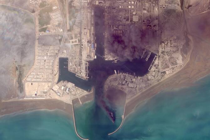
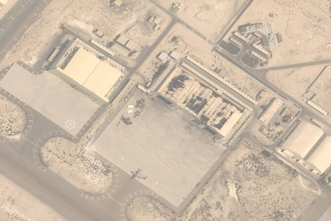


DUBAI: Satellite images are beginning to be released giving a glimpse into the toll of the Iran war, with ships ablaze in an Iranian port and destroyed buildings at American bases in the region.
Information has so far been scarce about the damage being done across the Middle East, particularly when it’s inside closed military facilities, since the war started on Feb. 28.
The images come from Planet Labs PBC, a San Francisco-based firm used by media outlets. Planet Labs has put a two-week delay on its imagery becoming public, citing concerns its imagery could be used by “adversarial actors.”
High-resolution images also have been published by competing firms. Other providers, like the US Geological Survey, have been publishing lower-resolution imagery as well that’s been useful.
Some of the most dramatic images from Planet Labs so far have been in Bandar Abbas, home to a major Iranian military port next to the crucial Strait of Hormuz connecting the Arabian Gulf to the Gulf of Oman and the Arabian Sea.
Planet Labs’ images from March 6 show damage to several buildings at the Parchin military base outside Tehran, Iran’s capital.
Bahrain, home of the US Navy’s 5th Fleet, has seen heavy Iranian fire targeting both military bases and oil installations.


