A bitter territorial dispute mars India-Nepal ties

https://arab.news/p5459
Amid rising tensions with China over territorial sovereignty, India has got entangled in another land dispute with Nepal – a nation which has historically shared with it a unique friendship characterized by open borders and deep rooted people-to-people contacts of kinship and culture.
In November 2019, India’s Narendra Modi regime unilaterally included Kalapani – a disputed region where the borders of Nepal, China and India meet – in a new political map, drawn after splitting Indian-administered Kashmir.
Months later, Katmandu retaliated in kind by unveiling their version of a document, claiming sovereignty over Kalapani, Limpiyadhura and Lipulekh, after failing to engage a stubborn New Delhi diplomatically over the inauguration of a 75 km road linking Kailash-Manasarovar area in Tibet, and running straight through territories claimed by Nepal.
While Nepalese authorities have long argued that their country’s border with China extends to Lipulekh Pass, in the Kalapani area, and moves further westward up to Limpiyadhura, New Delhi has consistently disputed this claim, citing tax records and other administrative documents.
Baburam Bhattarai, former Prime Minister of Nepal, categorically informed me that the Sugauli Treaty of 1816 (Article V) and the consecutive complimentary treaty of 1860 (Article III), ratified by both sides, explicitly spells out the demarcation of the India-Nepal border, and concluded Katmandu’s sovereignty over Kalapani area comprehensively.
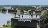
India and Nepal are hanging on to two different sets of documents displaying divergent origin and course of the same river, as they bicker over a 372 sq. km strategic area providing a bird’s eye view of the Chinese frontier.
Seema Sengupta
Buddhi Narayan Shrestha, Nepal’s land survey department’s former director general who headed the Indo-Nepal joint boundary committee, told me the counter-claims over the authenticity of maps have been a major hindrance in resolving the territorial dispute.
“At the 1997 joint boundary task force meeting, India rejected Nepal’s proposal to adopt Survey of India’s 1857 map as the reference point to settle all differences on boundary alignment in the western sector, claiming it to be unscientific due to absence of control points,” Shrestha said and added that Nepal’s experts, for their part, refused to accept India’s use of Survey of India’s 1879 map instead, which shows Kalapani as Indian territory.
Though both Nepal and India have formally accepted the Kali river as the defining boundary that divides the two nations, they continue to differ over the origin of the headwaters.
Ironically, the source and course of a river became a bone of contention in a territorial dispute between two friendly neighbors, only because the British imperialist power had tweaked maps to consolidate its grip over a strategically critical territory, for accruing economic and geopolitical dividends in the mid-nineteenth century.
Hence, all maps produced by British cartographers, between 1816 and 1857, depicted Limpiyadhura as the origin of River Kali, thus inferring that the land to the west of the stream, including Kalapani and Lipulekh pass, belongs to Nepal.
However, post-1857, realizing the geostrategic and commercial significance of Kalapani, British officials started publishing maps showing the origin of River Kali to the east of Kalapani.
Consequently, India and Nepal are hanging on to two different sets of documents displaying divergent origin and course of the same river, as they bicker over a 372 sq. km strategic area providing a bird’s eye view of the Chinese frontier. Bhattarai described this unilateral attempt to alter the river’s source as cartographic aggression, igniting a protracted territorial dispute.
As Bhattarai underscored the importance of an enduring relationship between the two nations, even the traditional bonhomie and successive Indian political leadership’s commitment to address the contentious boundary dispute, through honest technical evaluation and mutual accommodation, could not help delineate the course of the River Kali to date, which would have solved the vexed issue permanently.
Shreshta opines that downgrading the negotiation process to a technical committee level prevented any possibility of a breakthrough, because it was beyond the experts’ capacity to draw a final conclusion on a politically sensitive dispute.
With India apparently in no mood to compromise, the solution has to be innovative – like Nepal leasing out Kalapani to India for the long term in exchange for strategic benefits like acquiring land corridor rights for hastening trade to Bangladesh, once New Delhi concedes sovereignty and makes a solemn commitment to deploy only Gorkha troops in the area to assuage bruised Nepalese sensitivities.
Bhattarai feels room for alternatives and accommodation will arise once an understanding is reached at the diplomatic and political level, and does not rule out a land-swap deal without compromising national interests.
However, that entails building up trust and discouraging ultra-nationalist jingoism. Modi’s muscular foreign policy, leading to the economic blockade of Nepal in 2015, provoked a groundswell of hostility against India. And Bhattarai believes emancipation lies in implementing his brainchild, the Nepal-India ‘Eminent Persons’ Group’ consensus report on improving bilateral relations, and issue-based engagement on contentious matters-- without damaging the plinth of a time-honored friendship.
*Seema Sengupta is a Kolkata-based journalist and columnist.


")

")